New Orleans Waterfront Plan Takes Shape
New Orleans Waterfront Plan Takes Shape
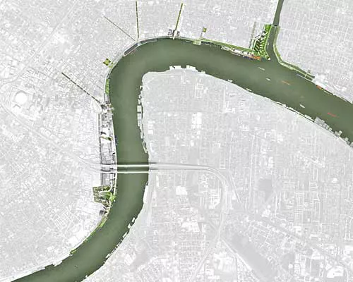
The redevelopment zone runs for 4.5 miles along the east bank of the Mississippi River from Jackson to Poland Avenues past the Lower Garden district, Warehouse, and Central Business Districts as well as the French Quarter, Marigny, and Bywater neighborhoods.
Image courtesy TEN Arquitectos
New Orleans Waterfront Plan Takes Shape
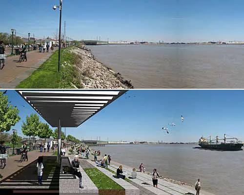
The Moonwalk, a promenade along the Mississippi River fronting Jackson Square in the center of New Orleans, will be transformed.
Images courtesy New Orleans Building Corporation
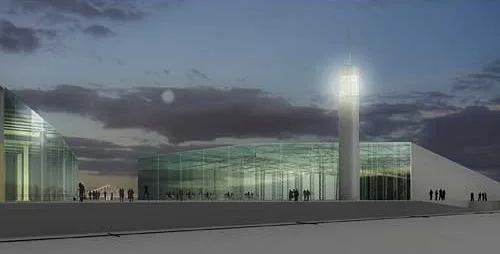
New Orleans Waterfront Plan Takes Shape
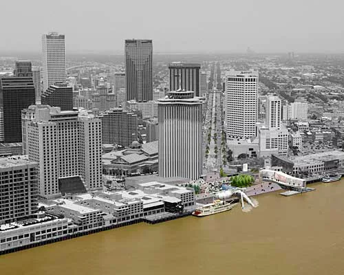
A new ferry terminal and other amenities will be constructed at the foot of Canal Street.
Image courtesy TEN Arquitectos
New Orleans Waterfront Plan Takes Shape
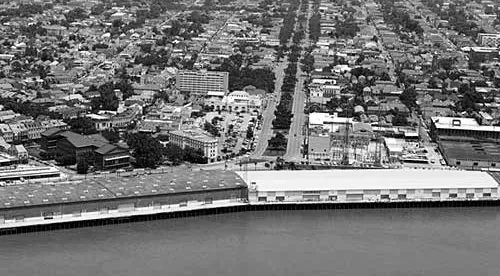
East of Jackson Square, a warehouse at the foot of Esplanade and Elysian Fields avenues will be cut in half.
Image courtesy New Orleans Building Corporation
New Orleans Waterfront Plan Takes Shape
When the center of the warehouse has been removed, views will be opened up to the waterfront from Esplanade and Elysian Fields avenues.
Image courtesy TEN Arquitectos
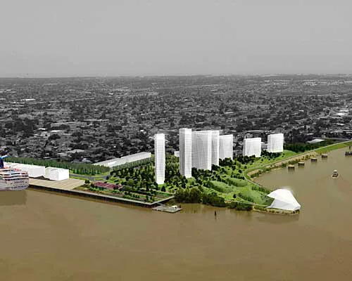
New Orleans Waterfront Plan Takes Shape
New housing could be constructed further east of New Orleans’s center, along the banks of a levee bordered by the Holy Cross neighborhood.
Image courtesy TEN Arquitectos
Looking for a reprint of this article?
From high-res PDFs to custom plaques, order your copy today!
