Making Places: Public Spaces in Chicago
Reclaiming defunct infrastructure, a series of new public paths and parks invite locals and visitors to gather, play, or simply enjoy navigating the city's neighborhoods.
Reclaiming defunct infrastructure, a series of new public paths and parks invite locals and visitors to gather, play, or simply enjoy navigating the city's neighborhoods.
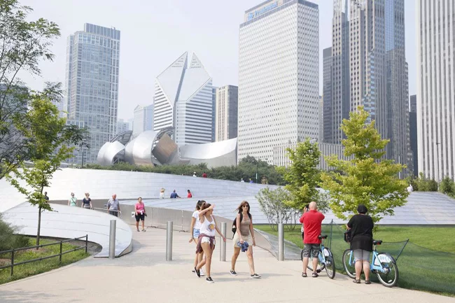
These vignettes exemplify a new burst of place-making in Chicago. As if in anticipation of the crowds that are expected to descend upon the city for the Chicago Architectural Biennial, Mayor Rahm Emanuel has recently dedicated four signature public spaces: the Riverwalk, a sleekly modern addition to the Beaux Arts retaining wall along the Chicago River; the 606, a winningly un-slick 2.7-mile bike trail and chain of narrow parks that slices through four neighborhoods on the city’s Northwest Side; Maggie Daley Park, a kid-centric pleasure ground of more than 25 acres just east of the wildly popular Millennium Park; and the southern part of Northerly Island, a 40-acre ecological showcase of man-made hills, a lagoon, and campgrounds that’s a short cab ride away from the Loop.
These diverse projects have something in common: the transformation of outmoded transportation infrastructure into prime public space. The Riverwalk replaces decrepit docks. The 606 supplants a defunct elevated railroad freight line. Maggie Daley Park supersedes a dull 1970s park that was built atop a lakefront parking garage. Northerly Island was a small shoreline airport, mostly used by politicians shuttling between Chicago and the state capital in Springfield, until one night in 2003 when former Chicago Mayor Richard M. Daley, in a Robert Moses moment, sent out city backhoes that carved giant X’s into its runway and shut it down.
As Emanuel told me, not without reason, when he showed off Northerly Island, “We are at the epicenter of taking old transportation platforms and turning [them] into public spaces.”
The new spaces build upon physical and conceptual foundations laid in the early 20th century, when architect and planner Daniel Burnham articulated a vision that led to Chicago’s nearly continuous 26-mile chain of parks along the shore of Lake Michigan. But, to their credit, the designers of the new spaces are creatively adapting Burnham’s industrial-age ethic to the digital age, forgoing stiff European-inspired formality and the banal “mow, blow, and go” aesthetic of suburban office parks. Their looser arrangements foster new forms of interactivity. Whether these pleasure grounds are tightly confined linear spaces, like the Riverwalk and the 606, or broader plots, like Maggie Daley Park and Northerly Island, they reflect the increasingly prominent role of landscape architects, who are turning once-marginal areas of cities and regions into new centers of civic life.
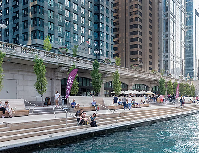
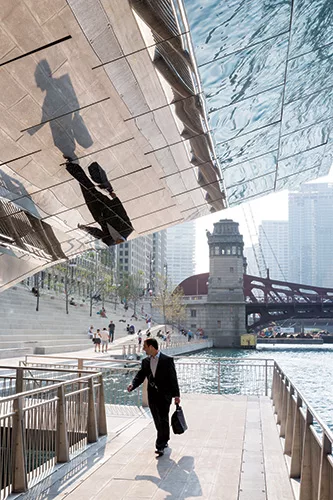
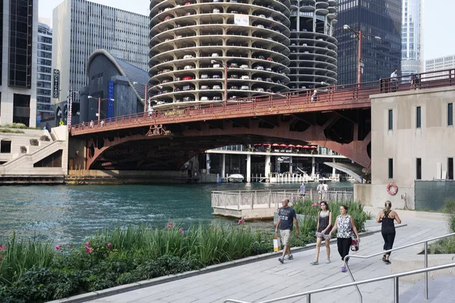
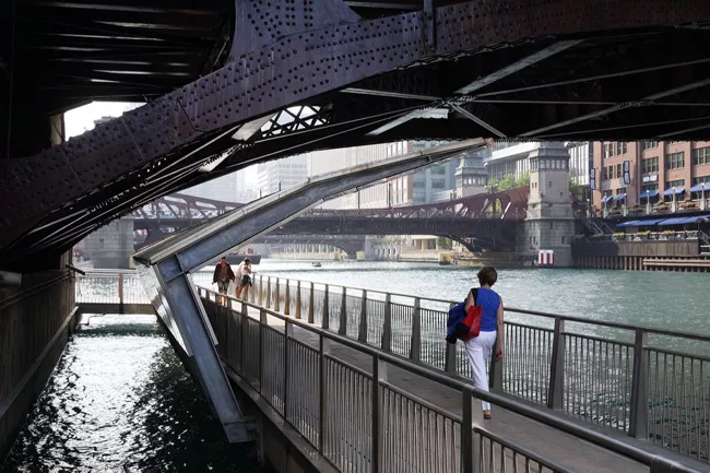
The three-block-long, $110 million extension of the Riverwalk is the most prominent—and, to date, the most successful—example of this trend. Set on the lower level of double-deck Wacker Drive, an urban ring road inspired by Burnham’s 1909 Chicago Plan, the hardscrabble docks along the Chicago River’s south bank resembled a scene from the 1954 movie On the Waterfront. The absence of a walking path beneath the river’s bascule bridges rendered the riverfront even less appealing, forcing strollers to climb stairs to the upper-level of Wacker Drive, cross a city street, and then descend in order to get from one section of the waterfront to another.
To create continuity and bring pedestrians close to the water, the team of Sasaki Associates, Ross Barney Architects, and Alfred Benesch engineers lowered the decades-old dock platforms by several feet, extended the shoreline 25 feet into the river’s roughly 200-foot-wide channel, and built pedestrian pathways beneath the bridges. The bridges effectively delineate three vibrant, roomlike outdoor spaces: the Marina Plaza, whose high-backed teak benches offer dazzling views of Marina City; the Cove, where people sprawl on low-slung benches, resembling seals on rocks baking themselves in the sun; and the River Theater, a monumental flight of steps that is equally suited to lunchtime brown-baggers and crowds gathered to hear music.
The design achieves a compelling synthesis of consistency and variety, and an equally effective counterpoint of tradition and modernity. Another three-block extension, now under construction, will join with this and earlier sections of the Riverwalk to create a continuous 1¼-mile pedestrian and bike path reaching from Lake Michigan to the meeting of the Chicago River’s north and south branches. Along with smartly designed riverfront boathouses in outlying neighborhoods by Jeanne Gang and Chris Lee, the Riverwalk reveals how Emanuel is turning the river into the city’s “second waterfront.” The change is gathering momentum, even though the river’s still-polluted waters contain levels of disease-causing bacteria that routinely exceed state standards for recreational waterways. Emanuel’s public works are bringing Chicagoans to the edge of, as well as onto, the once-neglected body of water.
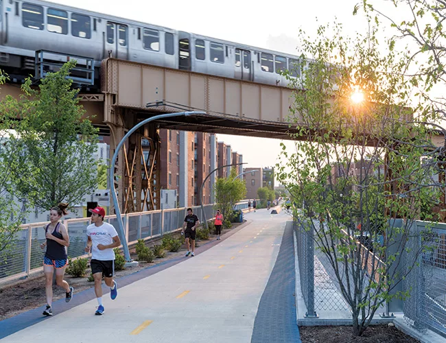
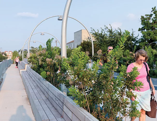
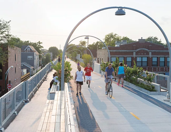
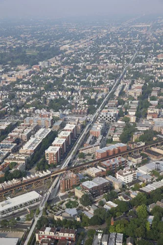
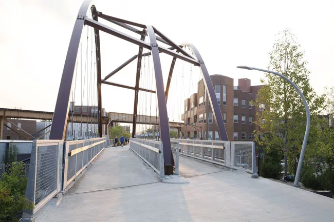
While the 606 isn’t as camera-ready as the Riverwalk, it is having an equally transformative impact, bringing open space to off-lakefront neighborhoods that desperately needed it.
Designed by the team of Collins Engineers, Michael Van Valkenburgh Associates, and artist Frances Whitehead, the 606 is, in many respects, the anti–High Line of New York: more earthbound than ethereal, more geared to locals than tourists, and more utilitarian than uber-chic. In all that, it is quintessentially Chicago. As the design blogger Matt Hickman wrote when the 606 opened, “Whereas the High Line is the high-end cocktail lounge where one might take fancy out-of-town cousins to show off, the 606 promises to be more of a comfortable dive bar—a real neighborhood joint.”
His forecast was on target. Named for Chicago’s zip code prefix and built atop a concrete-framed earthen embankment rather than a skeletal elevated line, the $95 million 606 consists of a central concrete trail for bikes, and rubberized shoulders for joggers and strollers. The trail itself is called the Bloomingdale Trail in acknowledgment of the city street that runs parallel to it. Access ramps link the path to street level, and a chain of four parks has been built at ground level, because there wasn’t enough room atop the embankment. Today, the landscaping is underwhelming. But once an “arcade” of grasses, plants, and trees matures—it will include evergreens, paperbark maples, and sumacs—it should create an almost-cinematic montage of greenery for cyclists zipping down the trail.
On weekends, to be sure, the 606 gets crowded. Most of the time, though, it’s soothing and expansive. While the Riverwalk brings people below street level to a cool and quiet realm, the trail lifts them above urban congestion. Sharpening the 606’s contrast with the Riverwalk’s urbane downtown milieu, the elevated perspective allows trailgoers to peek (almost literally, at second-story levels) at the way people live in residential neighborhoods. And there are myriad practical benefits. Residents of the heavily Latino neighborhoods that adjoin the trail use it not just to walk, jog, or ride bikes, but to get to the grocery store, the doctor, or their jobs. Yet in correcting long-term inequities in the provision of open space, the 606 has brought rising real-estate values and the threat of gentrification. How sad it would be if, as the 606’s landscape grows in, the very people it was built to serve are priced out.
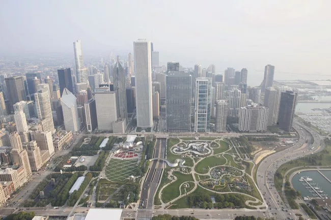
Because the $60 million Maggie Daley Park and the $9.7 million southern stretch of Northerly Island occupy Chicago’s already spectacular lakefront, they can’t match the transformative impact of the Riverwalk and the 606. Nonetheless, they are altering the shoreline and pushing the conceptual envelope of public space.
Renzo Piano once cracked that the snaking Frank Gehry–designed overpass that leads eastward from Millennium Park to the land now occupied by Maggie Daley Park was a “somewhere to nowhere bridge.” That was right. The park that used to be there was so ordinary that people simply stopped at the end of Gehry’s span and turned around. But that park sat atop an underground garage.
And when the membrane that protected the garage from groundwater deteriorated, it was ripped off like a bad toupee. That opened the door for Maggie Daley Park, which is named for Chicago’s late longtime first lady, wife of former Mayor Daley.
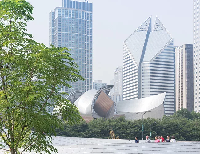
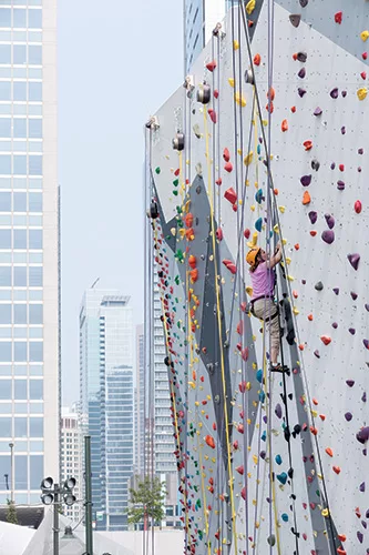
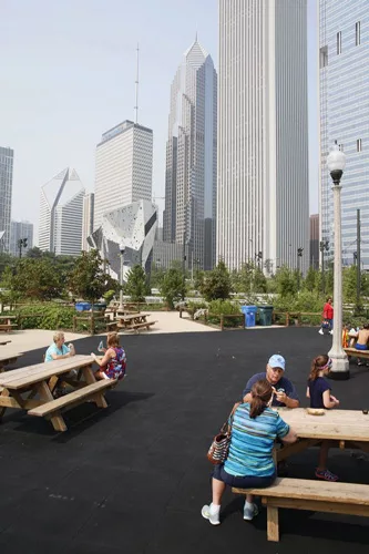
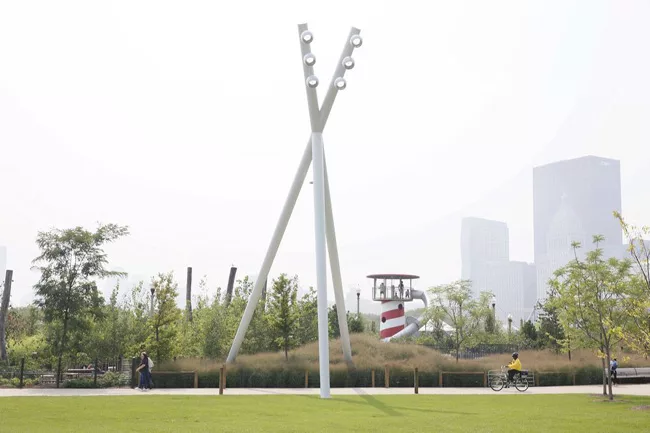
With its climbing walls and an ice-skating ribbon that wends its way around them and evergreen trees, the park has been an instant hit with the public. Hives of kids run, climb, slide, holler, and laugh as they enjoy colorful play equipment with skyline views that no suburban playground can match. Another Van Valkenburgh creation, the park effectively mixes the recreational with the pastoral; its diagram is an X consisting of intersecting areas for passive recreation and active play. While its play spaces pick up on the interactivity of Millennium Park’s Cloud Gate sculpture and Crown Fountain, gently sloping lawns, perfect for picnicking, form a welcome respite from the joyful frenzy of the children’s play zones. Unfortunately, the lawns are lined with clunky, tripod-shaped light masts that resemble giant praying mantises.
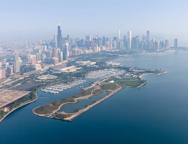
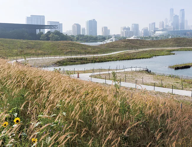
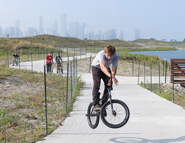
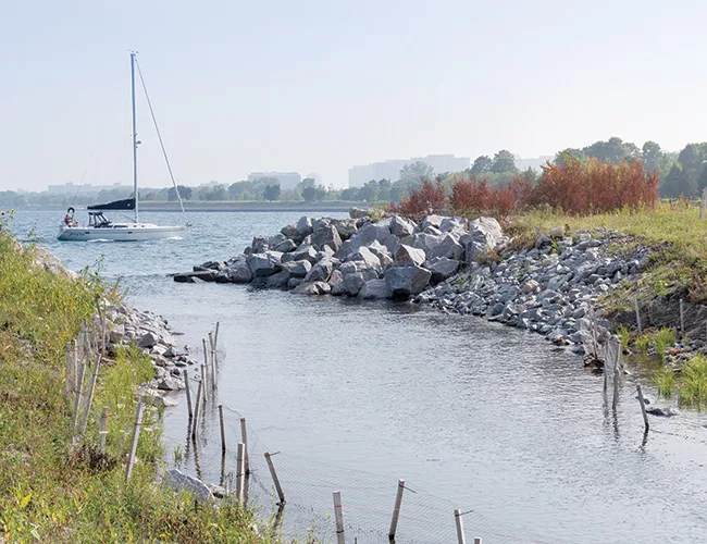
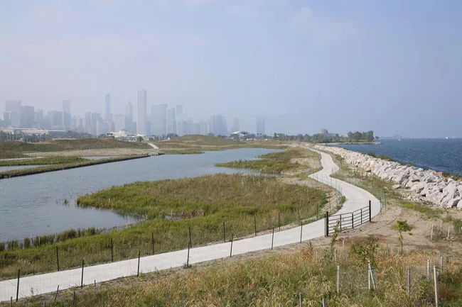
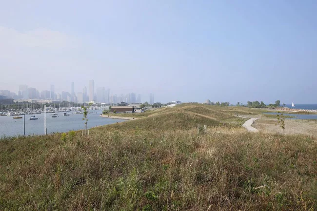
The just-opened Northerly Island promises to be far more serene. In place of the airport and its pancake-flat landscape, SmithGroupJJR, Studio Gang Architects, and the U.S. Army Corps of Engineers have shaped man-made hills, a five-acre lagoon, and a winding mile-long path for bikes, strollers, and bird watchers. The design, which Jeanne Gang has compared to a “Millennium Park of nature,” recreates habitats, from ponds and marshes to prairie and savannas, that existed before development overran Chicago. It sounds like an eco-Disneyland, but the result has the feel of authenticity and the urban wild. Fish already are spawning in the wetlands. Great blue herons alight there too. City kids will be able to camp in the park. They’ll see stars in the dark night sky, hear the roar of the waves on Lake Michigan, and emerge, it is hoped, with a sense of wonder.
In his great 1909 Plan of Chicago, Burnham wrote, “the lakefront by right belongs to the people.” It is remarkable, more than a century later, that his democratic axiom still resounds and even more remarkable that his words continue to inform and inspire Chicago’s latest crop of public spaces—though these pleasure grounds possess a geographic scope and creative spark that Burnham himself never imagined.
Architectural Record contributing editor Blair Kamin is The Chicago Tribune’s architecture critic and the editor of Gates of Harvard Yard, to be published in spring 2016 by Princeton Architectural Press.
Looking for a reprint of this article?
From high-res PDFs to custom plaques, order your copy today!


